![](/images/other/stat-length.png)
Mon Compostelle Vingt quarième étape
Ardeiserois
User
![Length](/images/other/stat-length.png)
Length
50 km
![Max alt](https://static1.geolcdn.com/siteimages/upload/files/1508320355ic_sort_altitude_max_24dp.png)
Max alt
904 m
![Uphill gradient](https://static1.geolcdn.com/siteimages/upload/files/1508320355ic_sort_den_pos_24dp.png)
Uphill gradient
442 m
![Km-Effort](/images/other/stat-length.png)
Km-Effort
56 km
![Min alt](https://static1.geolcdn.com/siteimages/upload/files/1508320355ic_sort_altitude_min_24dp.png)
Min alt
799 m
![Downhill gradient](https://static1.geolcdn.com/siteimages/upload/files/1508320355ic_sort_den_neg_24dp.png)
Downhill gradient
419 m
![Boucle](https://static1.geolcdn.com/siteimages/upload/files/16400158638029165_repeat_loop_refresh_sync_direction_icon.png)
Boucle
No
Creation date :
2017-02-06 00:00:00.0
Updated on :
2017-02-06 00:00:00.0
![Walking](https://static1.geolcdn.com/sitytour/trail-icons/101.png)
9h25
Difficulty : Difficult
![Scan this QR Code to open this trail in the SityTrail application](https://capi.geolives.com/qq0zvz2zws4bq2lad0pu/sitytour/trails/693940/qr.png?size=200)
FREE GPS app for hiking
About
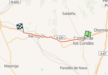
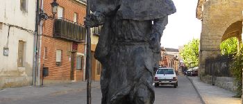
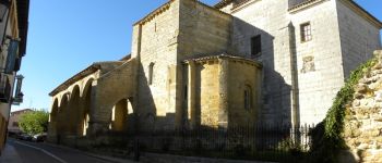
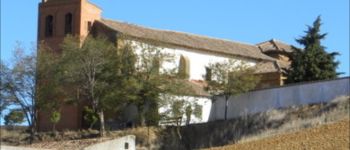
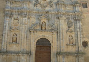
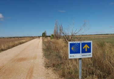
Trail Walking of 50 km to be discovered at Castile and León, Unknown, Carrión de los Condes. This trail is proposed by Ardeiserois.
Description
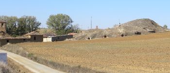
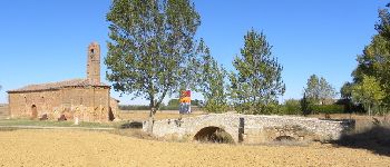
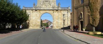
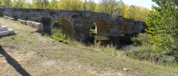
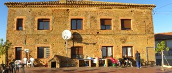
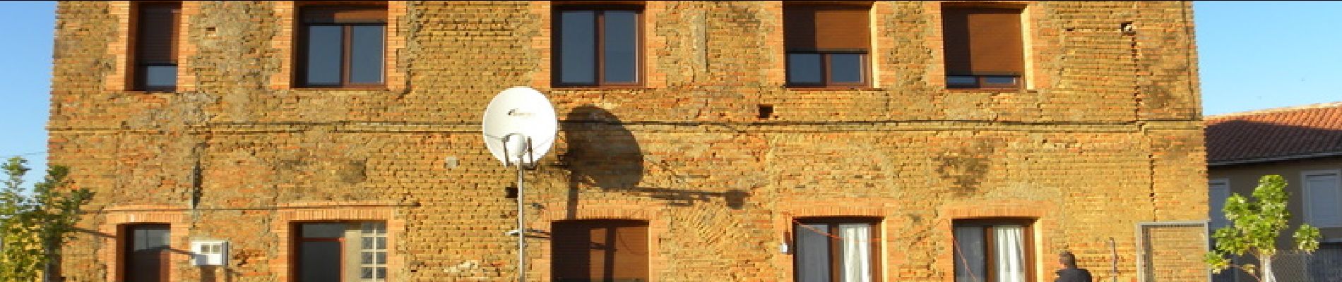
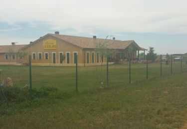
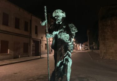
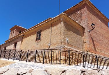
Vingt quatrième étape, vendredi 16 octobre, 2009,Carrion de los Condes /Bercianos del Real Camino :
Départ : 6h50,
Arrivée : 16h15
Points of interest
Positioning
Country:
Spain
Region :
Castile and León
Department/Province :
Unknown
Municipality :
Carrión de los Condes
Location:
Unknown
Start:(Dec)
Start:(UTM)
368314 ; 4688418 (30T) N.
Comments
Trails nearby
![Walking Walking](https://static1.geolcdn.com/sitytour/trail-icons/101.png)
CC_Frances_CD_16_Villalcazar-Sirga_Cervatos-Cueza_20110707
Walking
Very easy
Villalcázar de Sirga,
Castile and León,
Palencia,
Spain
![](/images/other/stat-length.png)
23 km | 25 km-effort
5h 10min
![](https://static1.geolcdn.com/siteimages/upload/files/16400158638029165_repeat_loop_refresh_sync_direction_icon.png)
No
![Walking Walking](https://static1.geolcdn.com/sitytour/trail-icons/101.png)
27.04.18 Carrion de los Condes--Moratinos
Walking
Medium
Carrión de los Condes,
Castile and León,
Unknown,
Spain
![](/images/other/stat-length.png)
30 km | 33 km-effort
7h 11min
![](https://static1.geolcdn.com/siteimages/upload/files/16400158638029165_repeat_loop_refresh_sync_direction_icon.png)
No
![Trail Walking Carrión de los Condes - Compostelle 50 - Carrión -> Terradillos de los Templarios - Photo](https://media.geolcdn.com/t/375/260/ext.jpg?maxdim=2&url=https%3A%2F%2Fservices.sitytrail.com%2FGeolivesWS%2FDownloadMedia.ashx%3FTrailID%3D859316%26Media%3Dfix__20170509152642.jpg)
![Walking Walking](https://static1.geolcdn.com/sitytour/trail-icons/101.png)
Compostelle 50 - Carrión -> Terradillos de los Templarios
Walking
Medium
Carrión de los Condes,
Castile and León,
Unknown,
Spain
![](/images/other/stat-length.png)
26 km | 28 km-effort
5h 10min
![](https://static1.geolcdn.com/siteimages/upload/files/16400158638029165_repeat_loop_refresh_sync_direction_icon.png)
No
![Trail Walking Carrión de los Condes - 2023 10 27 CAMINO FRANCES - 35ème étape : Carrion de Los Condes - Calzadilla de la Cueza - Ledigos - Terradillos de Los Templarios - Moratinos - Sahagún - Photo](https://media.geolcdn.com/t/375/260/7c228532-571d-49e8-906c-e5d74cf68861.jpg&format=jpg&maxdim=2)
![Walking Walking](https://static1.geolcdn.com/sitytour/trail-icons/101.png)
2023 10 27 CAMINO FRANCES - 35ème étape : Carrion de Los Condes - Calzadilla ...
Walking
Very difficult
Carrión de los Condes,
Castile and León,
Unknown,
Spain
![](/images/other/stat-length.png)
42 km | 47 km-effort
7h 10min
![](https://static1.geolcdn.com/siteimages/upload/files/16400158638029165_repeat_loop_refresh_sync_direction_icon.png)
No
![Trail Walking Villalcázar de Sirga - Calzadilla de la Cueza - Photo](https://media.geolcdn.com/t/375/260/5a528131-91d9-4143-965c-9b2942e7b697.jpg&format=jpg&maxdim=2)
![Walking Walking](https://static1.geolcdn.com/sitytour/trail-icons/101.png)
Calzadilla de la Cueza
Walking
Very difficult
Villalcázar de Sirga,
Castile and León,
Unknown,
Spain
![](/images/other/stat-length.png)
23 km | 25 km-effort
6h 53min
![](https://static1.geolcdn.com/siteimages/upload/files/16400158638029165_repeat_loop_refresh_sync_direction_icon.png)
No
![Trail Walking Carrión de los Condes - 2023 17 templiaros - Photo](https://media.geolcdn.com/t/375/260/1e26fdd6-791e-48b2-9da5-30a0e09a6e53.jpg&format=jpg&maxdim=2)
![Walking Walking](https://static1.geolcdn.com/sitytour/trail-icons/101.png)
2023 17 templiaros
Walking
Easy
Carrión de los Condes,
Castile and León,
Unknown,
Spain
![](/images/other/stat-length.png)
27 km | 30 km-effort
6h 9min
![](https://static1.geolcdn.com/siteimages/upload/files/16400158638029165_repeat_loop_refresh_sync_direction_icon.png)
No
![Trail Walking Carrión de los Condes - 2023 10 27 CAMINO FRANCES - 35ème étape : Carrion de Los Condes - Calzadilla de la Cueza - Ledigos - Terradillos de Los Templarios - Moratinos - Sahagún - Photo](https://media.geolcdn.com/t/375/260/726e9dce-2494-47bf-a288-208f37d8b52f.jpg&format=jpg&maxdim=2)
![Walking Walking](https://static1.geolcdn.com/sitytour/trail-icons/101.png)
2023 10 27 CAMINO FRANCES - 35ème étape : Carrion de Los Condes - Calzadilla ...
Walking
Very difficult
Carrión de los Condes,
Castile and León,
Unknown,
Spain
![](/images/other/stat-length.png)
42 km | 47 km-effort
8h 6min
![](https://static1.geolcdn.com/siteimages/upload/files/16400158638029165_repeat_loop_refresh_sync_direction_icon.png)
No
![Trail Walking Carrión de los Condes - Etape 4 de Carrion de las Condès à Sahagun - Photo](https://media.geolcdn.com/t/375/260/ext.jpg?maxdim=2&url=https%3A%2F%2Fstatic1.geolcdn.com%2Fsiteimages%2Fupload%2Ffiles%2F1553511878bg_sport_marche.png)
![Walking Walking](https://static1.geolcdn.com/sitytour/trail-icons/101.png)
Etape 4 de Carrion de las Condès à Sahagun
Walking
Easy
Carrión de los Condes,
Castile and León,
Unknown,
Spain
![](/images/other/stat-length.png)
41 km | 45 km-effort
11h 42min
![](https://static1.geolcdn.com/siteimages/upload/files/16400158638029165_repeat_loop_refresh_sync_direction_icon.png)
No
![Trail Walking Carrión de los Condes - Carrion de los Condes - Calzadilla de la Cueza - Photo](https://media.geolcdn.com/t/375/260/ext.jpg?maxdim=2&url=https%3A%2F%2Fstatic1.geolcdn.com%2Fsiteimages%2Fupload%2Ffiles%2F1553511878bg_sport_marche.png)
![Walking Walking](https://static1.geolcdn.com/sitytour/trail-icons/101.png)
Carrion de los Condes - Calzadilla de la Cueza
Walking
Very difficult
Carrión de los Condes,
Castile and León,
Unknown,
Spain
![](/images/other/stat-length.png)
18.1 km | 19.8 km-effort
5h 54min
![](https://static1.geolcdn.com/siteimages/upload/files/16400158638029165_repeat_loop_refresh_sync_direction_icon.png)
No